52°North has a long tradition in developing OGC standards. We are committed to advancing geospatial interoperability, evident through significant contributions to several, past, key specifications, such as

52°North has a long tradition in developing OGC standards. We are committed to advancing geospatial interoperability, evident through significant contributions to several, past, key specifications, such as

Fostering continuous learning and growth through knowledge transfer
The purpose of the R&D framework agreement is to utilize the services of 52°North to make the innovation process at con terra more effective and cost-efficient. This contract is designed to provide planning certainty and a long-term commitment for both companies.
con terra’s innovation goals center on evaluating methods and technologies for their solutions and then bringing these ideas to life through pilots and components. They are committed to executing well-defined innovation projects across multiple company domains. To achieve this, 52°North and con terra collaborate under a framework contract and use tools such as consulting, feasibility studies, prototyping, and joint product development. Knowledge transfer through workshops and training sessions is integral, fostering continuous learning and growth within both organizations.
Many interesting topics were covered in 2023. We investigated the possibilities of AI tools for everyday software engineering tasks and how they meet the requirements of con terra product development. In another activity, we established hands-on workshops and training sessions on the latest release of the OpenLayers framework. These workshops were closely related to the “Open Pioneer” Trails endeavour. With “Open Pioneer” con terra and 52°North have established a workbench for the development of new concepts, ideas and technologies in the context of future and innovative SDI. Open Pioneer Trails is an open development platform for web clients that enables the development of customized GeoIT solutions. It is designed as a framework, but not as a fixed solution or product. The map components are built upon OpenLayers and provide many basic web map functionalities such as base layer management, geolocation and search.
Find more details on Open Pioneer and Trails at the Open Pioneer GitHub repository.

con terra GmbH, Germany

Open Science Persistent Demonstrator is a multi-stakeholder initiative to facilitate the creation and communication of reproducible Earth Science.
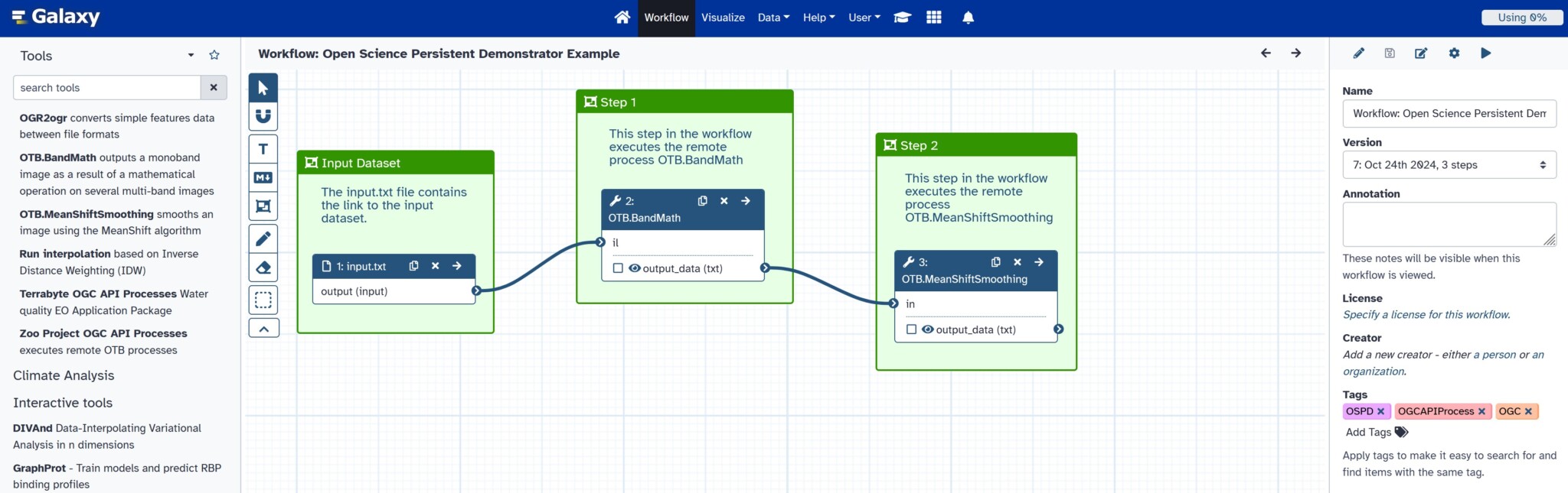
The Open Science Persistent Demonstrator (OSPD) aims to foster collaboration in Earth Observation research based on Open Science principles by facilitating the creation of readily shareable and standards-compliant workflows. The initiative is developing a persistent distributed infrastructure to improve the discoverability, interoperability, documentation, and archiving of data, processing services, and computational workflows. To achieve this, the OSPD combines a diverse community of platforms, workflows on Galaxy, OGC API standards, and the Open Science Framework, all introduced through a comprehensive training course. A major goal is to explore and demonstrate the interoperability between the Earth Observation cloud technologies developed by ESA and NASA.
52°North leads the task of exploring and realizing the integration of OGC API Processes into the Galaxy platform. Overall, the project runs for three years and consists of three phases, the first of which ended in 2024. Our team successfully developed a proof of concept for the integration of OGC API Processes into the Galaxy platform, which is already in use in the AquaINFRA research project.
Supporting the decision-making for adaptation to climate change
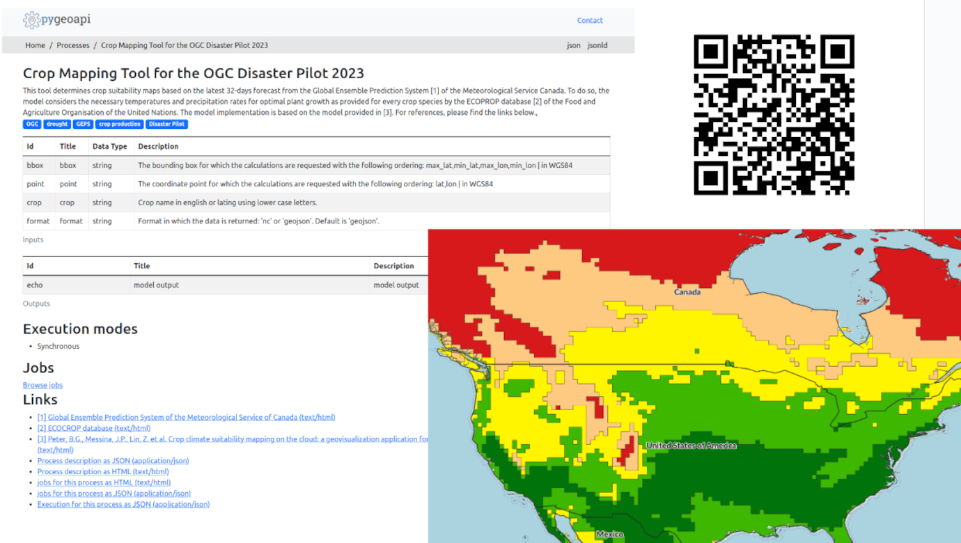
OGC DP23 aims to reduce the risk of climate hazards and to adapt to climate change. The designated research areas are in Manitoba, Canada, and California, USA, with their major climate hazards of droughts, floods and wildfires, respectively. Some deliverables focus on ways to improve the work of first responders and the health impacts of both disasters and climate change. All deliverables will use the latest OGC APIs and try to contribute to a modular workflow chain from Analysis Ready Data (ADR) to Decision Ready Indicators (DRI). The idea behind this is to transform primary data sources as provided by NASA, Canadian Met Service and Copernicus, e.g. , remote sensing or atmospheric data (ADR), with models and processes until they answer a very specific question (DRI). With the modular approach, the pilot aims to connect different workflows; for example, the intermediate result of one workflow could be the starting point (ADR) for another workflow.
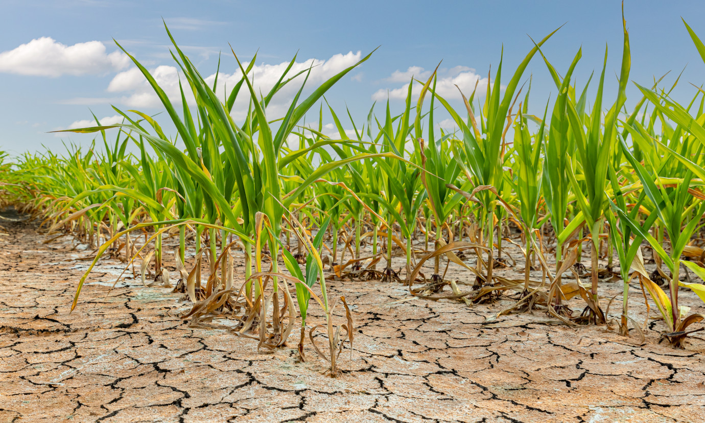
52°North focused on an indicator showing the impact of drought on various crops in the Manitoba region. In addition to financial losses for commercial farmers, droughts can severely impact indigenous communities that rely on harvesting their own crops for food security. A tool that compares different crop fitness levels with respect to drought stress could help in the decision-making process of finding the right crops to adapt to climate change.
To create this indicator, we used 30-day temperature and precipitation forecasts provided by the Canadian Met Service and fed them into the crop suitability model (Peter et al., 2020) using plant requirements for temperature and precipitation. The forecast is downloaded weekly and preprocessed (averaging across the different members of the ensemble model). Users receive a NetCDF file or a vectorized representation using contour polygons if they request a bounding box with categories of potential plant growth ‘marginal’ – ‘optimal’ for a given crop. Additionally, users can specify a point instead of a bounding box and will receive the plant growth category in a JSON format.