52°North has a long tradition in developing OGC standards. We are committed to advancing geospatial interoperability, evident through significant contributions to several, past, key specifications, such as

52°North has a long tradition in developing OGC standards. We are committed to advancing geospatial interoperability, evident through significant contributions to several, past, key specifications, such as
Enhancing Climate Resilience through WebAIS
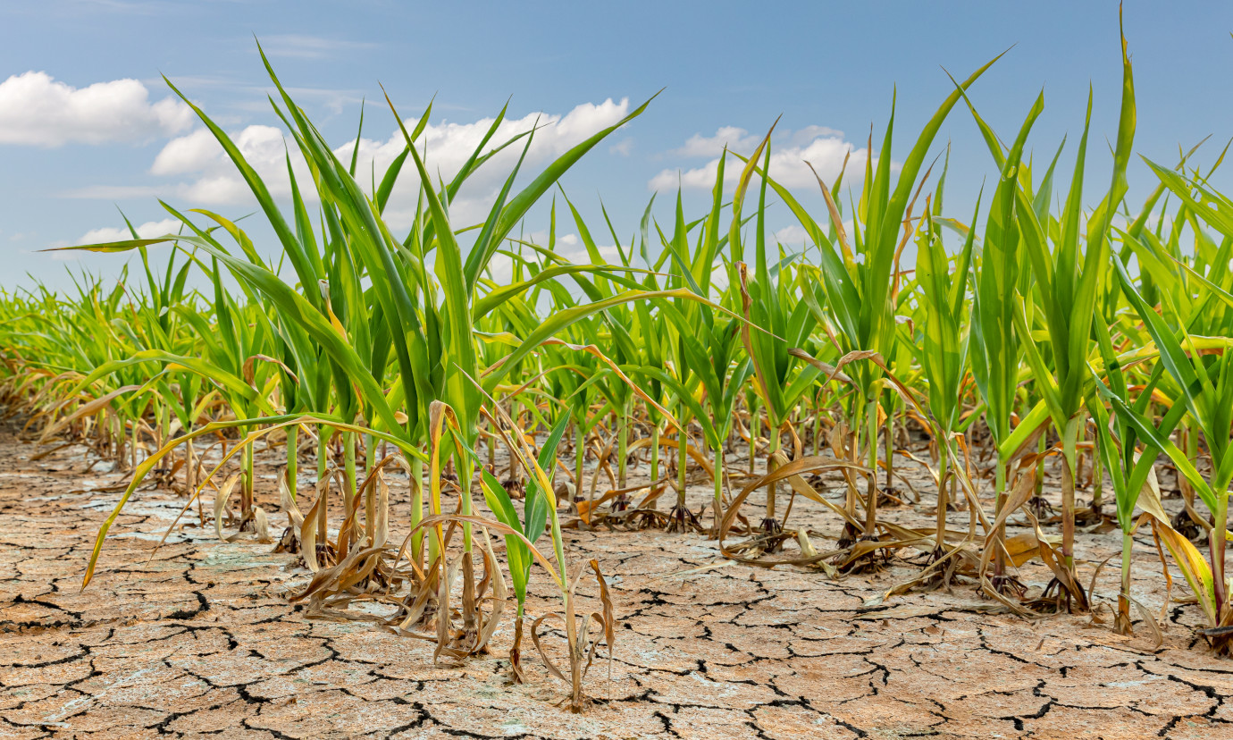
Agriculture is vital to Bangladesh’s economy, with irrigation playing a crucial role in food production. Despite a significant increase in irrigation coverage, from 3.4 million hectares in 2000 to 5.4 million hectares in 2013, unregulated groundwater extraction has led to declining groundwater levels, crippled irrigation systems, and increasing water scarcity. These challenges, coupled with climate change, underscore the need for sustainable water management. Web-AIS aims to integrate hydrological, crop, and climate models to provide real-time, data-driven solutions. Linked to the Bangladesh Agro-meteorological Information System (BAMIS), it will guide irrigation decisions, promote efficient use of surface water, and help address salinity issues. The overall goal of the project is to ensure food security by improving decision-making and supporting sustainable development while mitigating disaster risks.
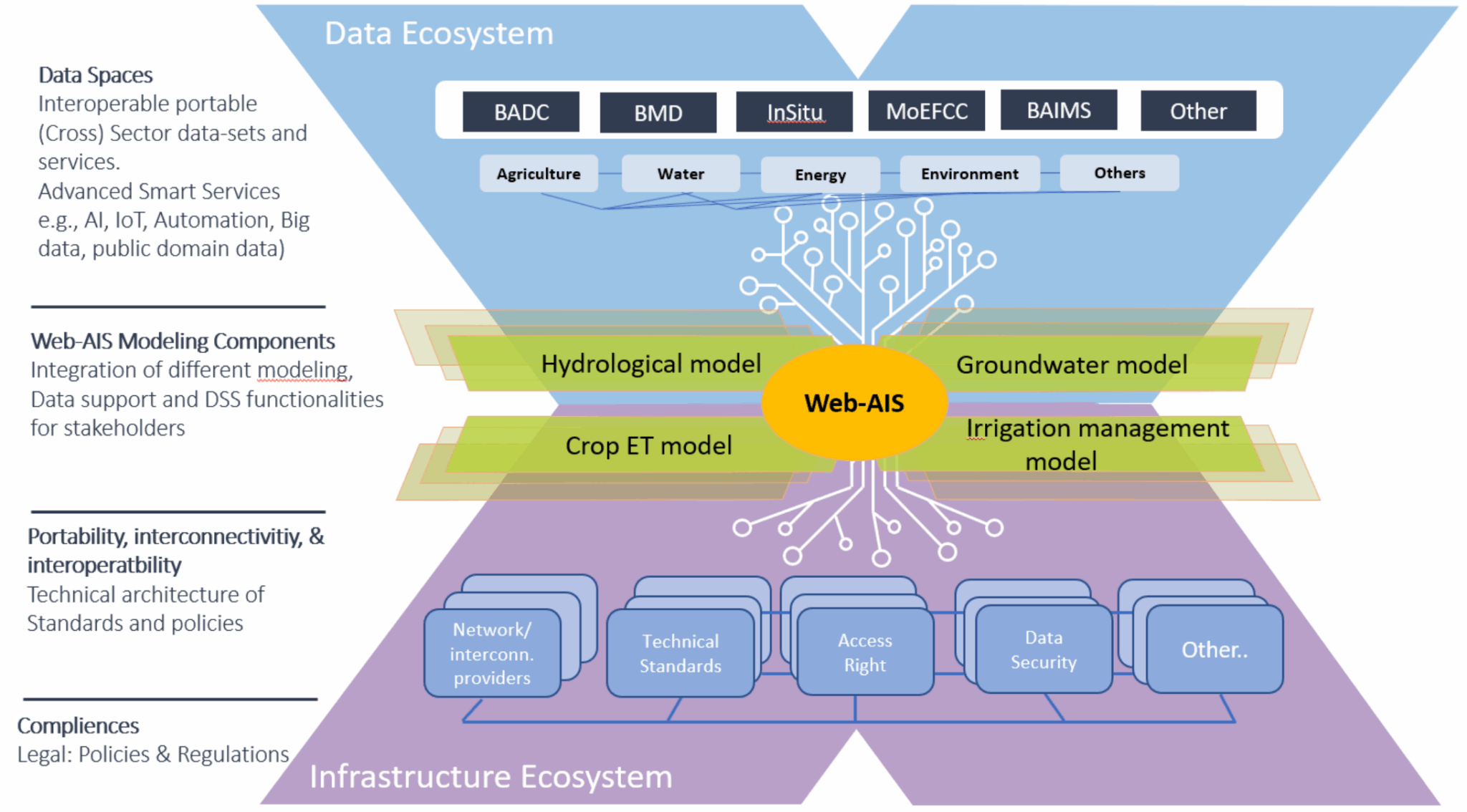
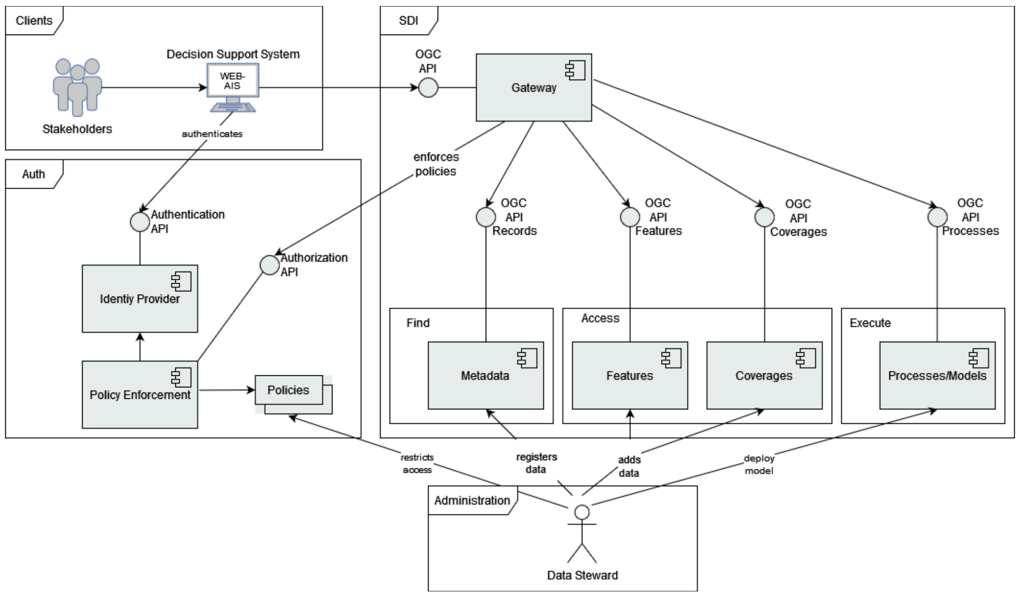
52°North’s main task is to implement a web-based information system that serves as a decision support system for all stakeholders. This system is the Web-AIS project’s central connection and interface to the local stakeholders and will include the products and results of all project partners. It provides access to relevant information on the current situation regarding irrigation management techniques, information on available water balance, crop water demand, irrigation schedule, and also issues early warnings in the case of drought or other extreme events that may affect the irrigation activities. The spatial data infrastructure (SDI) is the architecture’s core. It comprises various OGC API web services, such as OGC API – Features, OGC API – Records or OGC API – Processes. Our team uses open-source implementations of the various OGC API standards to realize the architecture. The concept of OGC API – Building Blocks allows the different forms of OGC APIs to be combined into one comprehensive, standardized API. The goal of this approach is to create a gateway that functions as the primary access point for client applications. We will develop a web-based front-end application using Open Pioneer Trails as the core of the web information system.
In 2025, development focused on integrating sensor measurements and time series data. The project partners installed sensors (e.g., for measuring soil moisture) in fields in Bangladesh. These already continuously generate new measurements. In order to make the acquired data available to the upcoming WebAIS platform users, we used the OGC API – Connected Systems to publish this data in a standardized manner. OGC API – Connected Systems is the latest OGC standard to discover, access and interact with time series data. Existing weather and climate data for Bangladesh were made accessible correspondingly.
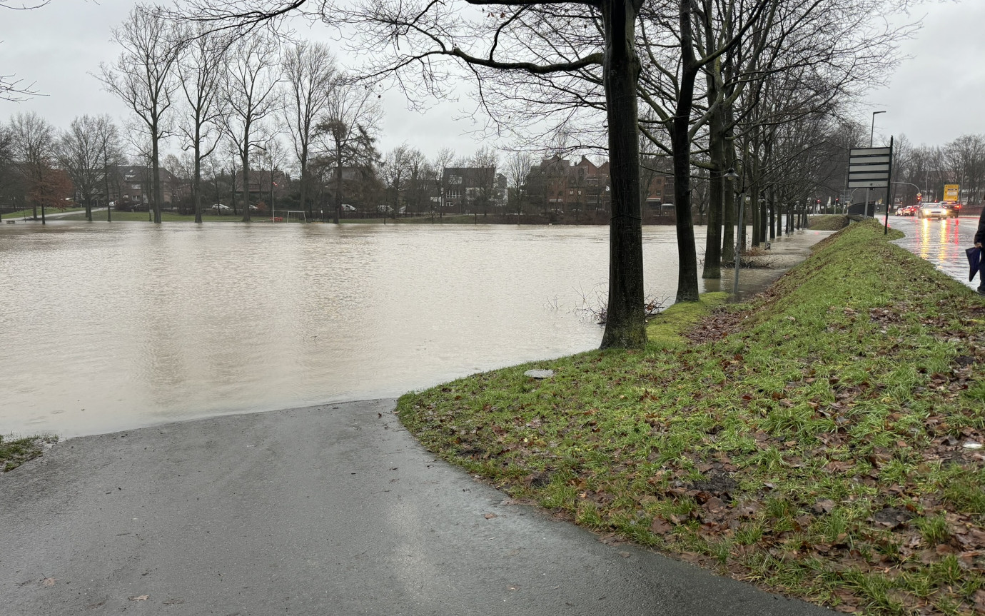
Ensuring the continuous provision of open satellite and weather data from flood warning and monitoring systems, as well as precipitation radar data
Following the devastating flash flooding in the Ahr valley in July 2021, the the importance of seamless access to near real-time information for event recovery was recognized. Consequently, a platform has been commissioned to process any Earth Observation data for the short-term integration of real-time data from ongoing floods and disasters. The goal was to ensure the continuous provision of open data satellite and weather data from flood warning systems (i.e, GloFAS) and flood monitoring systems (GFM, EMSR), as well as precipitation radar data from the German Weather Service (RADOLAN). The resulting information product contains the classified data sources as well as the raw data used and is made available in near real-time in WebGIS for further analyses.
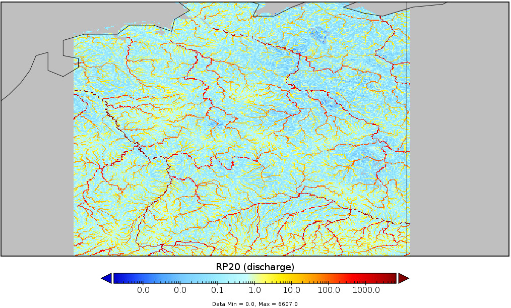
52°North calculated statistics on the aforementioned raster time series products and estimated pixel-by-pixel extreme value distributions. Based on the distributions, we derived thresholds according to a given return period per data source. We also jointly developed the architecture and workflow concept based on Argo. The platform pattern implements data stream enrichment with extensive processing on a highly scalable Kubernetes platform. Through the use of automated Argo workflows, it produces a daily information product derived from flood monitoring, forecasts, and identified areas of concern, all accessible via an API for subsequent processing. The co-created data is provides end users with decision-ready information.
con terra GmbH, Germany

Integration of tabular data resources in GeoNode
GeoNode as a content management system for (geo)spatial data offers a discovery platform and simple GIS tools to find and access data in an interoperable way. Non-spatial data can also made available as document entities. However, the upload of structured, non-spatial data has not been supported.
In the past Thünen software development project, 52°North prototyped an extension for the GeoNode importer module to upload so called tabular data resources. Tabular data resources can be provided as a data package, a simple container format for describing a coherent collection of data in a single package. A data package consists of metadata that describes the structure and contents of the package as well as resources, such as data files, that form the contents of the package. The implementation has shown that the data package format is a flexible and easily consumable format for GeoNode. Since then, the datapackage extension has been made available through the German GeoNode user group.
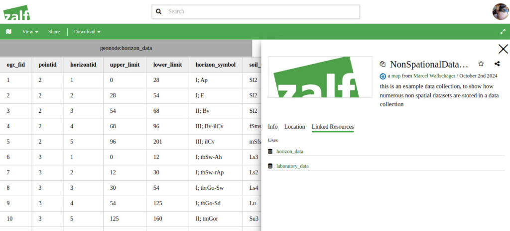
As part of the German GeoNode user group, the Leibniz Centre for Agricultural Landscape Research (ZALF) defined further requirements for the module and formulated special topics and features such as (non-exhaustive list)
52°North implemented all of the features defined above. In addition, our team resolved open issues and limitations regarding the integration of the new resource subtype and dataset handling. These improvements will in turn be incorporated into the development of the Thünen Atlas, which is currently under development. As part of the process, 52°North based the development on the GeoNode Blueprint, resulting in a recommended procedure template for developing other GeoNode contrib modules across multiple repositories.