 Enhancing Ecosystems Conservation via EO Solutions, Capacity Development and Co-design
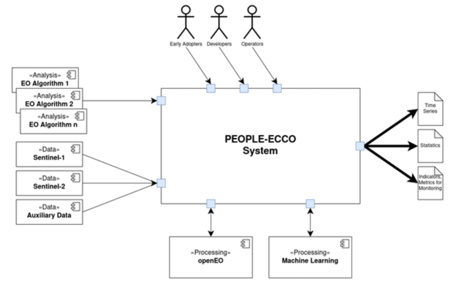
Designing and developing a platform to manage technical aspects of scalable EO algorithm execution
PEOPLE-ECCO (Enhancing Ecosystems Conservation through Earth Observation Solutions, Capacity Development, and Co-design) is an ESA-funded initiative under the Earth Observation Science for Society (EO4Society) programme. This project addresses crucial needs expressed by Civil Society Organizations (CSOs) and Non-Governmental Organizations (NGOs) that aim to enhance evidence-based ecosystem conservation. The PEOPLE-ECCO project follows two high-level objectives:
- Engage CSOs/NGOs active in ecosystems conservation by involving them in the co-design of EO methodologies (PEOPLE-ECCO Solutions) applicable in their operational practices and through EO capacity building activities;
- Develop, test, demonstrate and validate PEOPLE-ECCO Solutions based on the identified user requirements and co-design.
Six NGOs/CSOs, referred to as “Early Adopters,” play a pivotal role in the project by contributing to the creation of actionable, relevant EO-based tools and methods. These Early Adopters include African Parks, the Bulgarian Society for the Protection of Birds, the Lebanon Reforestation Initiative, IUCN Vietnam, the Prince Edward Island Watershed Alliance, and Reef Check Malaysia. Collectively, they represent efforts across four continents and manage a diverse array of terrestrial and aquatic ecosystems.
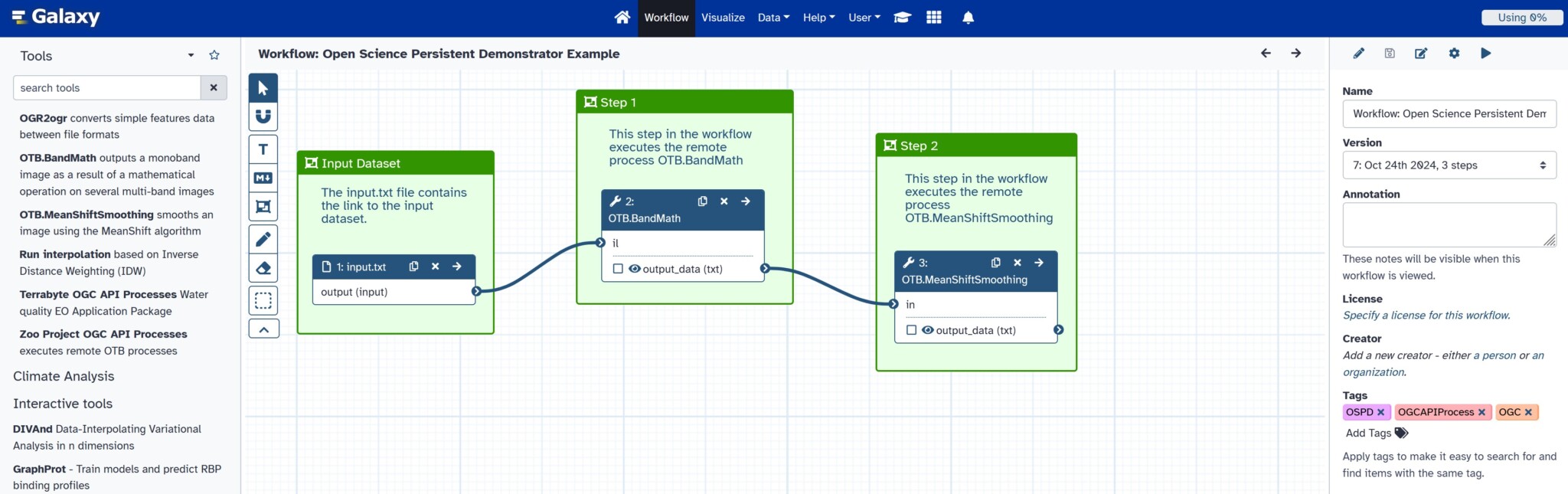
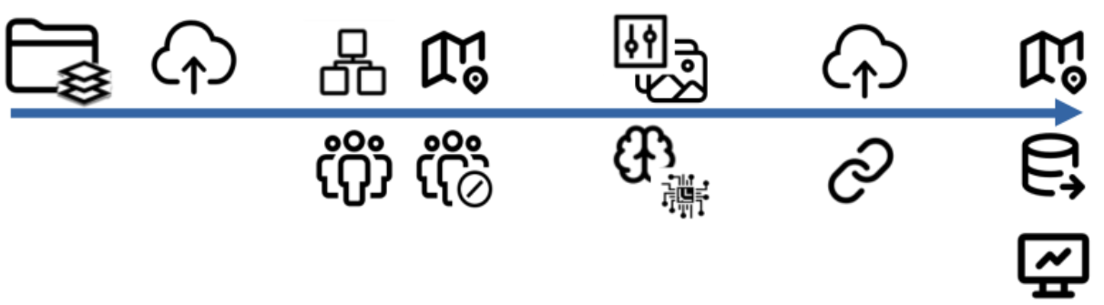
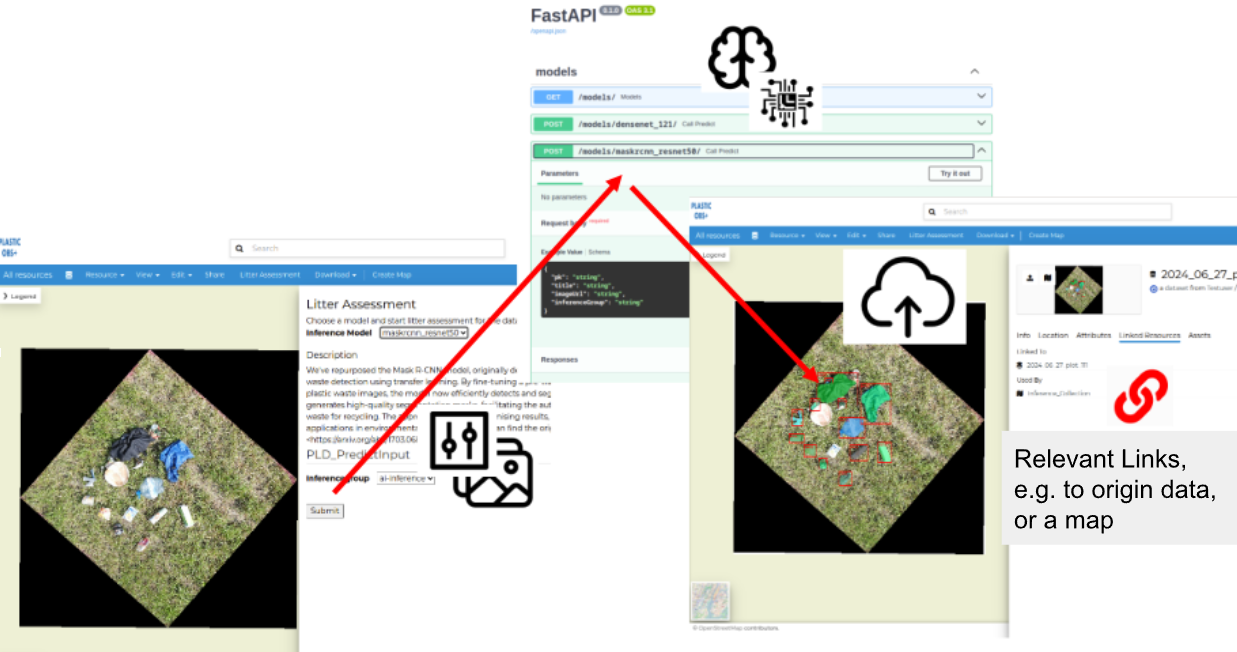
In 2025, 52°North developed the design of the PEOPLE-ECCO platform. It features a processing engine built on the EO Application Package (OGC API Processes + Common Workflow Language). All PEOPLE-ECCO Solutions will be integrated as individual EO Application Packages. The openEO platform (in the form of the Copernicus Data Space Ecosystem) is heavily used within these packages. Most processing steps are executed thereon. These range from data loading and subsetting to resampling and the derivation of indices, such as vegetation indices. All additional processing functionality is generically executed within the EO Application Package. This includes the application of Machine Learning models and change detection across a set of analytical time series.
The PEOPLE-ECCO platform will feature a rich user interface accessible via a browser-based application. There, the analytical results are organized and accessible via related test sites. Users can also execute additional analyses, such as increasing the temporal density of an analytical time series.
Partners
Customer
European Space Agency, France