GeoNode Serving as AI Inference Proxy
Supporting machine learning on multisensor data from airborne remote sensing
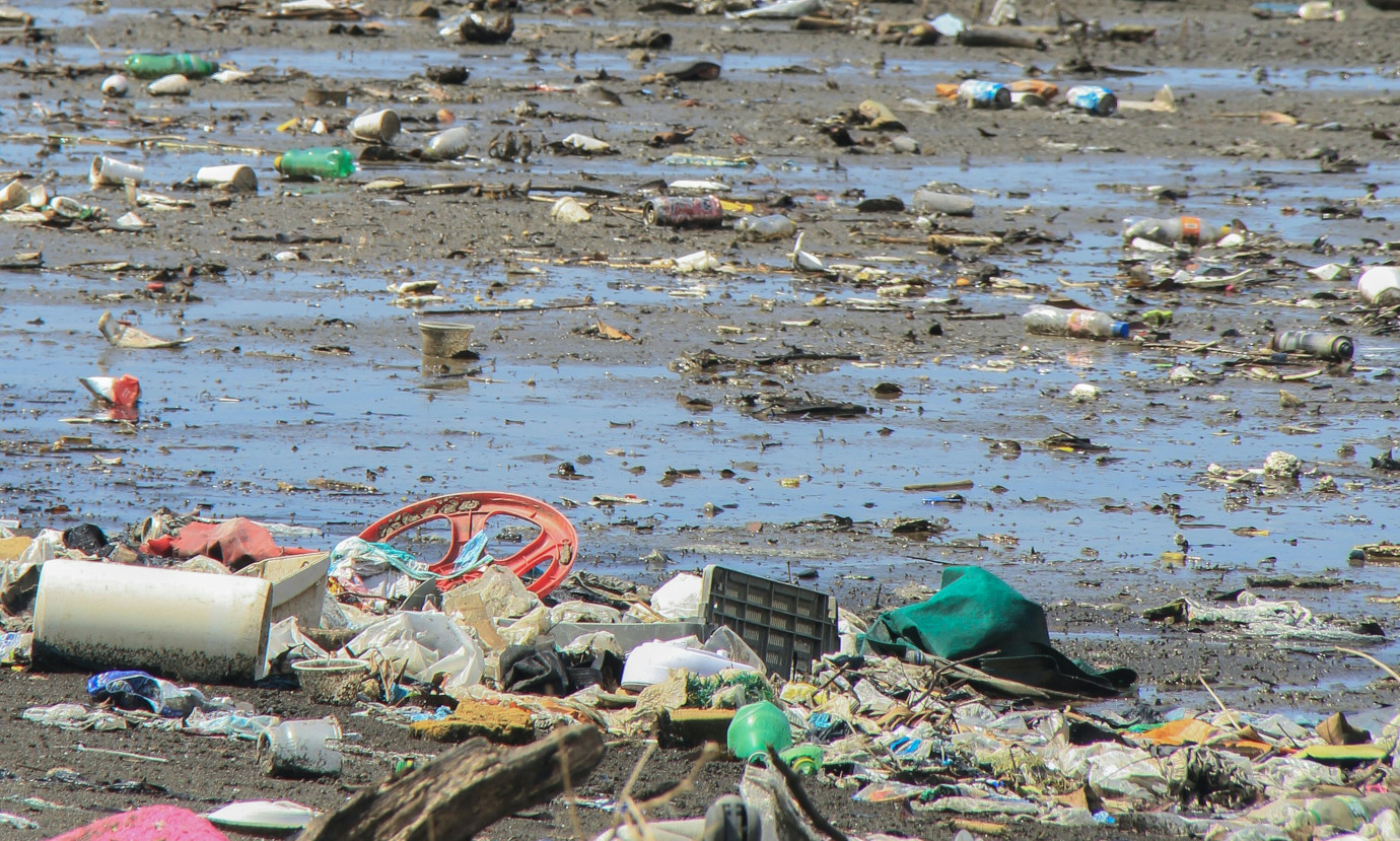
The PlasticObs_plus research project (funding code: 67KI21014A) is part of the BMUV (Federal Ministry for the Environment, Nature Conservation, Nuclear Safety and Consumer Protection) funding initiative “AI lighthouse projects for the environment, climate, nature and resources”. It investigated machine learning on multi-sensor data from airborne remote sensing to combat plastic waste in oceans and rivers. The project goal was to develop an integrated measurement system for routine, quasi-synoptic acquisition and visualization of the distribution of plastic debris on the ocean surface and on shorelines or coastal strips using remote sensing and artificial intelligence methods. In addition to the intended real-time data acquisition of plastic objects by airborne sensors, the downstream data analysis played a central role in the research project.
52°North supported the development of a geodata management platform to enable further processing of the raw data. Targeted audience are responsible public authorities to promote sustainable solutions to environmental pollution and targeted, effective counter-strategies.
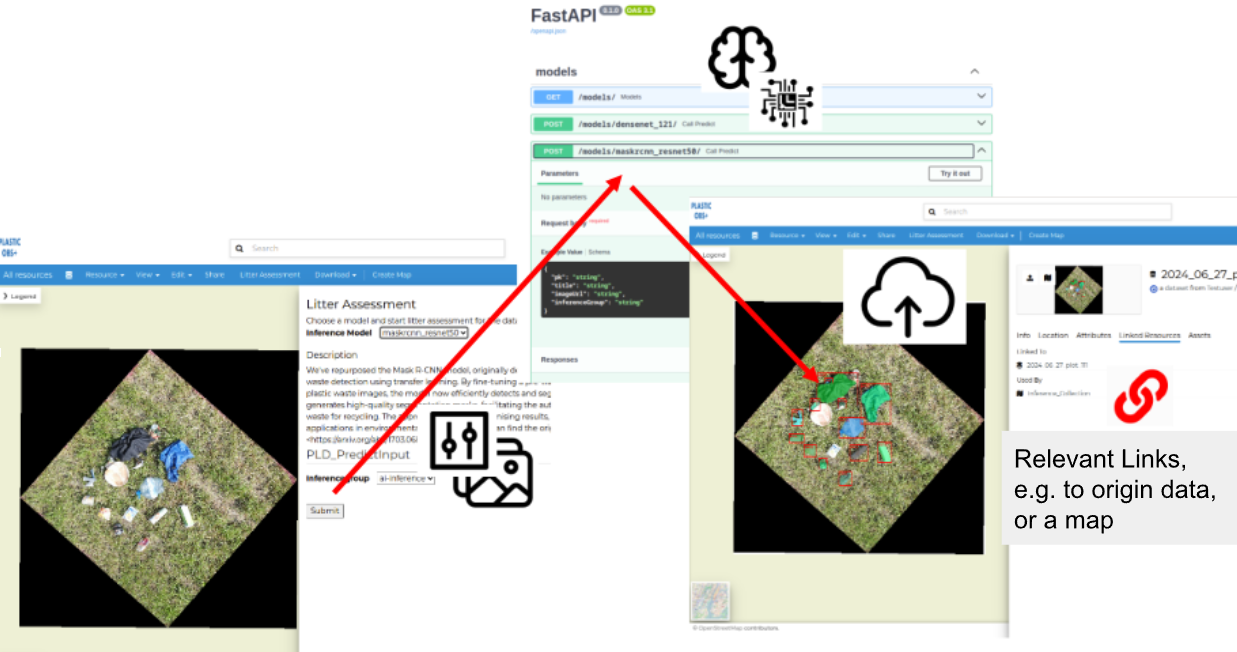
Following the requirements analysis and software launch in 2023 and ongoing development in 2024, 52°North developed a REST API to trigger AI inferences based on a given dataset plus input parameters defined by the API. Model metadata descriptions makes it possible to dynamically create an OpenAPI of the REST API.
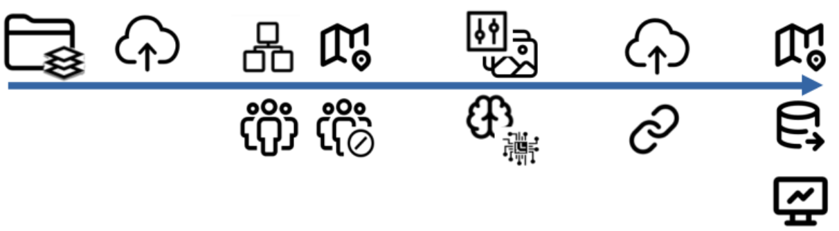
GeoNode is used as the core data platform for which backend and frontend extensions were developed. The frontend extension includes the automatic form generation of the required input parameters for an AI inference. This is done based on the dynamically created model descriptions via the OpenAPI. Actual requests to the REST API are proxied via the extension’s backend component. Since the execution of AI inferences often leads to high resource use, we decided that the REST API for triggering these inferences should only be available to authorized users. Once an inference is triggered (asynchronously), the result is uploaded back to GeoNode and linked to the input raster automatically.
The project ended in the first half of 2025. During the final stage, DFKI presented the outcomes to all stakeholders and relevant public authorities. Their feedback has been positive. Above all, the platform’s flexibility in integrating external AI models via the REST API has been praised. This feature allows users to solve use cases that go beyond the original use case. 52°North looks forward to providing support to advance the platform for any opportunities that may arise. The platform’s impact extends beyond the current project. It has been introduced to external audiences, such as the Prevent Waste Alliance (GIZ) and the Z-U-G (as a potential Citizen Science platform) and is anticipated to be adopted by future projects. The project partners recognize the platform’s significant potential as a core hub for upcoming geospatial initiatives and remain dedicated to its ongoing development.
Partners
OPTIMARE Systems GmbH, Germany
Jade Hochschule Wilhelmshaven/Oldenburg/Elsflet, Germany
everwave GmbH, Germany