• Github
  • Wiki
  • News
  • Blog
  • Search

52°North Spatial Information Research GmbH

exploring horizons

  • 52°North Spatial Information Research GmbH

    exploring horizons

  • About us
    • Profile
    • Scientific & Technical Advisory Board
    • Shareholders
    • Affiliations
    • Contact us
  • Research
    • Scope
    • Associated Labs
    • Publications
  • Software
    • Software components
    • Licensing
    • Contribute
  • Services
  • Solutions
  • Outreach
  • Careers
Home > Archives for MariData

July 6, 2023

Decision Support System Component Tests for MariData Project

Decision Support System Component Tests for MariData Project

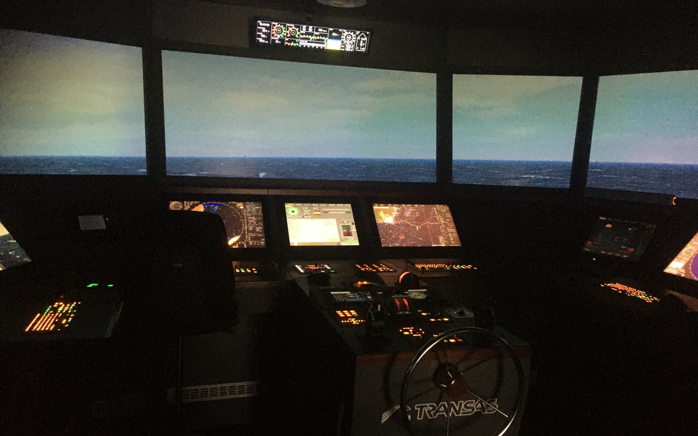
The ship simulator of the Flensburg University of Applied Sciences consists of an imitation of a ship’s bridge with corresponding control panels and screens for monitoring ship parameters and displaying cartographic material. A video projected on a curved screen surrounding the bridge gives the “ship’s crew” the feeling that they are sailing on the English Channel or any other chosen route. Different weather conditions can be selected for this projection, and although the bridge itself does not move, the video of waves hitting the ship from the sides makes the passengers sway in the desire to compensate for real waves.

more >

  • « Previous Page
  • 1
  • 2
  • News
  • Events
    • 52N Events
  • Careers
  • Contact Us
    • Legal Notice
  • Privacy Statement

Shareholders

  • con terra
  • esri inc
  • ifgiInstitute for Geoinformatics logo
  • itc
  • RSS
  • You Tube
  • Blueskybluesky logo
  • Fosstodon
  • LinkedIn

©2025 by 52°North Spatial Information Research GmbH. All Rights Reserved.