Analytics for Driving Automation Systems Service Areas
The analysis toolbox will help Volkswagen Commercial Vehicles provide data for their Automated Driving Systems.
The Operational Design Domain describes the conditions under which a driving automation system is designed to operate. This includes environmental and geographic information as well as the required presence or absence of certain traffic or roadway characteristics. At Volkswagen Commercial Vehicles, a dedicated team defines such boundary conditions for the development and testing process. This allows the team to evaluate potential service areas for Mobility as a Service applications. Based on our expertise in geospatial data analysis and efficient processing of large volumes of geodata, Volkswagen Commercial Vehicles contracted 52°North to develop a toolbox that enables the automatic derivation of these characteristics from available spatial datasets. Based on these characteristics, an annotated topological road network is generated that allows routing according to specific conditions.
The content-rich road network data provided by Open Street Map builds the foundation for the analysis toolbox. It enables the derivation of basic properties, such as the distribution of road types and street furniture, speed limits or number of lanes for a given area of interest. The toolbox also supports complex analysis capabilities, such as statistics on curve radius, the intersection impact angle, or intersection complexity. The system combines multiple analysis concepts:
- Basic analysis using the Python library osmnx
- Complex statistics using osmnx in combination with a PostGIS database
- Enrichment with third-party data sets (e.g. traffic signs)
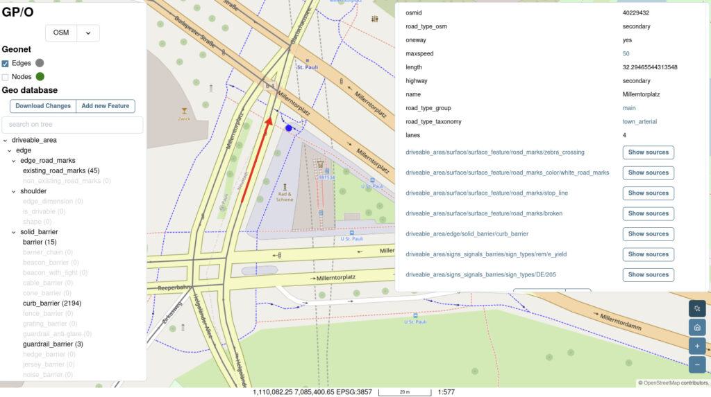
During 2024, the team focused on creating the annotated topological road network, the “GeoNet”. A broad range of parameters from the Operational Design Domain taxonomy were used in the annotation process. This included the previously developed complex analysis features, such as curve radius or visibility range. In addition, we developed a visualization component based on the Open Pioneer Trails framework to provide a sophisticated rendering of the generated GeoNet.

Customer
Volkswagen Commercial Vehicles ADMT, Germany
