Community Mapping with OGITO
Adapting and developing the OGITO application for new case studies
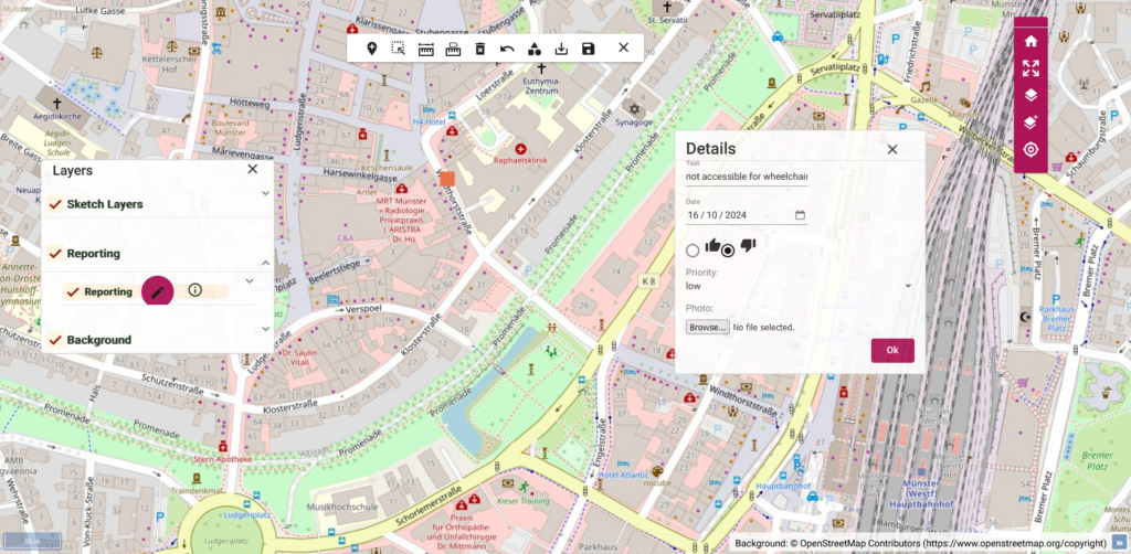
The Open Geospatial Interactive Tool (OGITO) is a open source application that supports collaborative spatial planning processes with a map table. OGITO was orginally developed by the Faculty of Geo-Information Science and Earth Observation of the University of Twente (ITC) for use in different community mapping projects. 52°North supported ITC and Hochschule für Gesundheit in adapting the existing mapping application for additional, future use cases. This included the implementation of new features but also the improvement of the (re-)usability of OGITO.
The Hochschule für Gesundheit planned to use OGITO for current noise mapping projects as well as for other future projects involving citizen participation. To improve adaptability and reusability, 52°North improved and extended the existing software. For improved citizen participation, we implemented a function that allows users to rate objects (e.g. noise reduction measures). It is also possible to create several projects in one deplyoment of the OGTIO software, thus improving the reusability of OGITO. Previously, a new deployment was required for each project. 52°North also held a workshop to train members of the Hochschule für Gesundheit to configure the existing OGITO software for future use cases.
OGITO’s web-based frontend builds upon the web application framework Angular and the open source mapping library OpenLayers. The backend uses a QGIS Server to make layers of spatial data that are defined and styled in a local QGIS project accessible to the frontend via OGC web services. PostGIS stores the spatial data that is integrated into the QGIS project. The source code and documentation of the OGITO software has been made publicly available in the 52°North Github organization under an open source license.

Customers
ITC, University of Twente, the Netherlands
Hochschule für Gesundheit (University of Applied Sciences), Germany
