Collaborative Early Warning Information Systems for Urban Infrastructures
A Web platform for developing urban early warning systems with a specific focus on fusing information derived from sensors, crowdsourcing, geosimulations, as well as administrative and historical data.
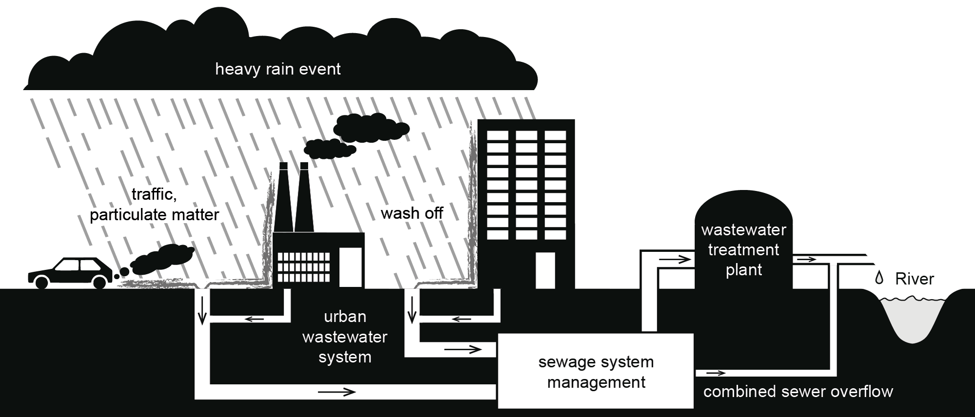
The COLABIS Project designed and implemented a Web platform that enables and eases the development of urban early warning systems, specifically focusing on information fusion derived from sensors, crowdsourcing, geosimulations, as well as administrative and historical data. The project focussed not only on local heavy rain, flooding and cascading events affecting urban water and sewage infrastructures, but also on traffic infrastructures. Pilot applications served as proof-of-concepts and helped to develop best practices. To support decision makers with timely and value added information, input data from various sources needs to be combined. This data fusion comprises data retrieval, enhancement, harmonization, similarity measures, matching, conflict detection and resolving. The consistency and reliability of results essentially depends on the underlying data quality, which varies over the different data sources. Therefore, quality metrics play a major role in COLABIS.
Architecture Design and Implementation
We developed methods and technologies to enhance linking crowdsourcing and the Sensor Web.
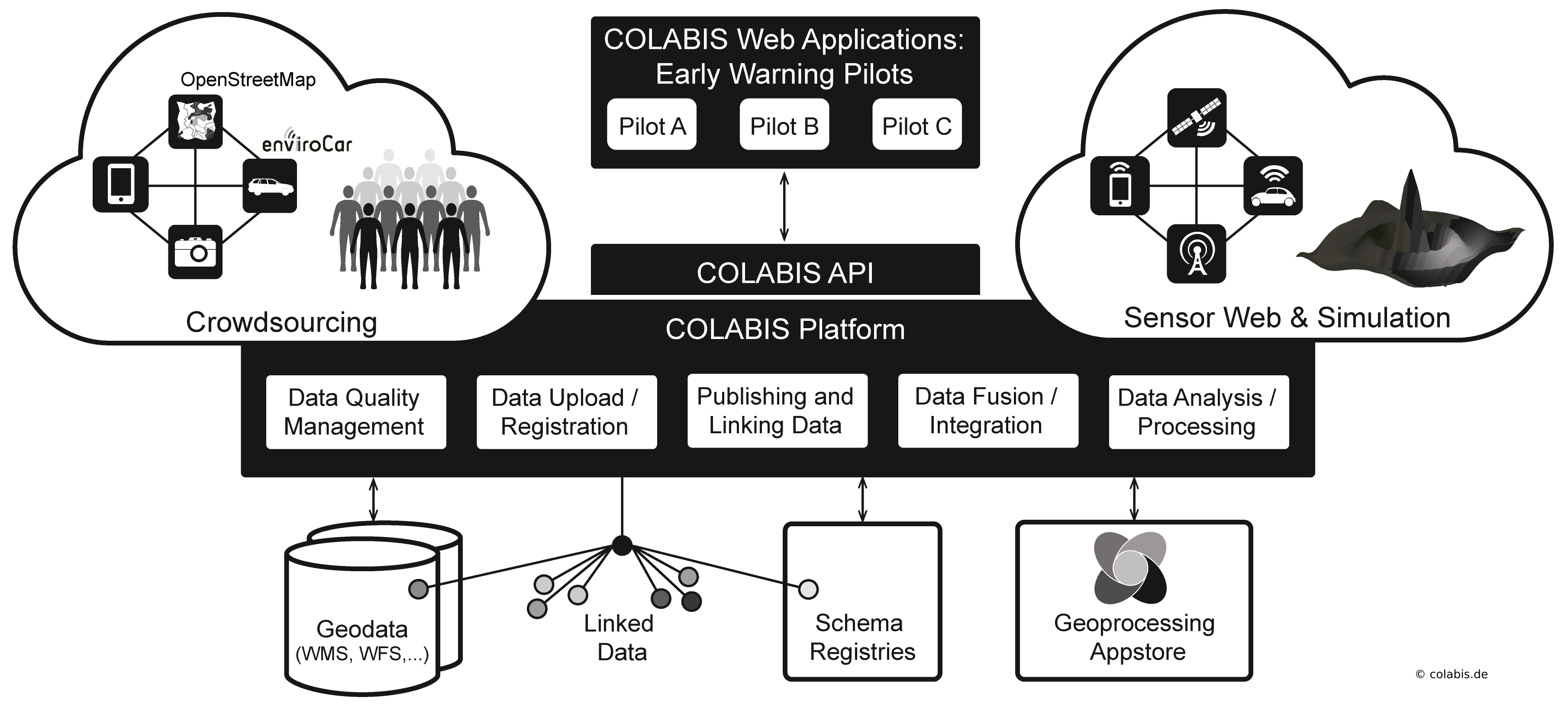
52°North’s role in the project comprised a contribution to architecture development on the one hand and the conceptual design and implementation of several building blocks of the COLABIS infrastructure on the other hand.
The following aspects in particular constitute the 52°North team’s core activities:
- Contribution to the architecture development
- Design and development of the COLABIS REST-API for simplifying the development of applications based on the COLABIS infrastructure: This comprises not only an important contribution to the development of the 52°North Sensor Web REST-API, but also the GeoCure project (proxy component for REST-based integration of content from WMS and WFS servers), the 52°North Eventing API (subscription to certain events in observation data streams) and the advancement of the REST-binding of the OGC WPS 2.0 standard
- CKAN-Harvester: Component for harvesting different types of geospatial data from CKAN Servers for publication via the COLABIS REST Platform. This includes support of the Schema Descriptors concept developed within the COLABIS consortium in order to support the interpretation of geospatial data sources based on a formal description of their structure.
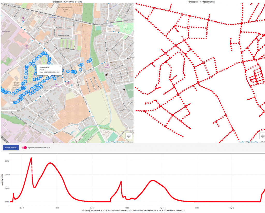
- Application development: Supporting the fast and easy development of lightweight spatial applications based on re-usable JavaScript building blocks (Helgoland Toolbox)
- Contribution to standardization (i.e. OGC): Discussion about REST-based interfaces for facilitating application development, evaluation of new standards for event-based communication flows (i.e. OGC Publish/Subscribe standard), and evaluation of the OGC SensorThings API through a first prototype implementation
In 2018, 52°North mainly focussed on the integration of COLABIS components into demonstrators and showcase implementations. Contribution to international standardization activities continued, however the 52°North team completed the development of new concepts and architecture building blocks in the previous years.
