MariData GeoPlatform and Routing
MariGeoRoute helps reduce the energy consumption of cargo ships by providing environmental data and forecasts and routing routines on a cloud-based data infrastructure to support energy optimized routing.
The MariData project is funded by the BMWK and aims to enable a deterministic analysis of a ship’s energy demand based on environmental and physical conditions. It sensibly delineates the ship’s energy demand based on various sources (e.g., waves, wind, etc.) and optimizes it by suggesting routing alternatives, speed and trim adjustments or additional services on the ship’s hull.
MariGeoRoute is a subproject addressing the challenges related to needs arising from the various data demands, such as nautical maps, weather records and forecasts ranging from wind and temperature to wave heights and currents. 52°North develops an integrated data store, the GeoPlatform, which will provide data for on shore services as well as for the ships at sea. It needs to sensibly subset and preprocess the data to reduce data load. We also develop approaches based on machine learning (ML) to model the energy demand based on the data collected and derived from the consortial partners. A routing service developed by 52°North will use the data accessible in the GeoPlatform to provide routing alternatives along the smallest energy demands under constraints of nautical limitations, ship safety and delivery schedules.
In 2022, 52°North focused on further developing the GeoPlatform. We deployed an instance of GeoNode in the cloud as a central element for collecting and managing different data sets. As a result, environmental forecasts (wind, wave, currents, etc.) from the Copernicus Marine Environment Monitoring Service and the Global Forecast System are imported into the GeoPlatform automatically. Historical ship routes used to evaluate the hydrodynamical models developed by the project partners are provided via a Sensor Things API. Our team also made preparational steps to integrate Open Sea Map data into the GeoPlatform in order to incorporate sea map information in the route optimization.
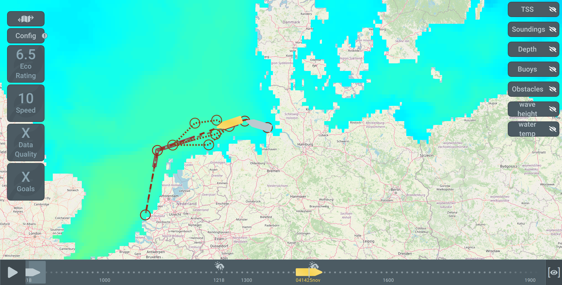
Front-end development comprised collaboration with a project partner to implement a user interface for route planning. We integrated the visualization of environmental data WMS layers so that they can be considered in the route planning process to make it more comprehensible to end users. In addition, 52°North’s team develops a routing algorithm based on the isochrone method. We have defined a routing API to get an optimzed route into the user interface and will implement it in the GeoPlatform in the next project phase.

Partners
Hamburgische Schiffbau-Versuchsanstalt GmbH (HSVA)
DST – Entwicklungszentrum für Schiffstechnik und Transportsysteme e.V.
Technische Universität Hamburg
