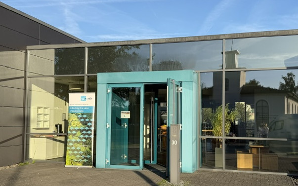
Exploring open Geo-IT, spatial digital twins, and responsible GeoAI in Münster, Germany
On September 22–23, 2026, researchers, industry leaders, software engineers, and public sector innovators gathered in Münster, Germany, for the 52°North Innovation Summit. Celebrating twenty years of open spatial development, the event provided an opportunity to assess past achievements and discuss future directions for open geospatial technology, spatial digital twins, and responsible GeoAI.
Since its establishment in Münster, 52°North has focused on connecting academic research, open-source development, and industry applications. Over the two-day event, attendees discussed historical milestones and addressed key technical, environmental, and ethical requirements. 52°North’s work continues to revolve around four core pillars:
- Open Code: Developing maintainable, community-driven geospatial software, tailored solutions and auditable analytics.
- Open Data: Unlocking high-value spatio-temporal datasets to fuel innovation and support public decision-making.
- Interoperability: Fostering open API standards and data specifications.
- Open Science: Enabling reproducible geospatial research workflows and robust Research Data Infrastructures (RDIs).
A recent milestone was the launch of the Spatial AI Nexus Münster (SAIN MS) (spatial-ai-nexus.ms). Designed as a regional transfer hub, SAIN MS aims to transition cutting-edge GeoAI research into practical open solutions for real-world application through collaboration between three primary partners:
- University of Münster (ifgi and CDSC): Driving scientific foundation, theoretical spatial modeling, and core AI research.
- 52°North: Delivering open-source development, OGC standards integration, and reproducible workflows.
- con terra: Providing enterprise-grade integration, market translation, and commercial access.
The hub focuses on priority transfer projects, including AI-supported workflows utilizing Large Language Model (LLM) agents for municipal climate adaptation, Spatial Retrieval-Augmented Generation (Spatial RAG) for legacy planning documents, and high-fidelity 3D Gaussian Splatting for dynamic infrastructure resilience and energy grid management.
Session Highlights & Technical Deep Dives
The comprehensive summit program brought together domain experts across multiple technical sessions, sharing perspectives that spanned high-level overviews to in-depth analysis:
- Research Data Infrastructures (RDIs) and FAIR Workflows: Presentations focused on hydrological connectivity modeling, standardized provenance tracking, and building FAIR data and workflow pipelines for environmental research.
- Urban and Regional Digital Twins: Discussions covered social digital twins, urban climate resilience, and spatial decision-support systems for public municipalities.
- Sustainability and Co-Design: Speakers shared breakthroughs in satellite Earth observation for forest monitoring, climate adaptation strategies, and the modernization of European data space standards.
- GeoAI and Intelligent Analytics: Sessions featured autonomous spatial agents, automated geospatial discovery, and practical deployment patterns for machine learning in spatial infrastructures.
- Geo-Innovations: Interactive presentations showcased real-world applications in smart search systems, autonomous mobility scaling, and spatial health intelligence.
Participants shared their own insights, opinions and future directions in lively discussions following the presentations.
Audience Insights, Polls, and Interactive Pulse
Live participant polling provided a snapshot of current GeoAI adoption, key bottlenecks, and fundamental ethical requirements.
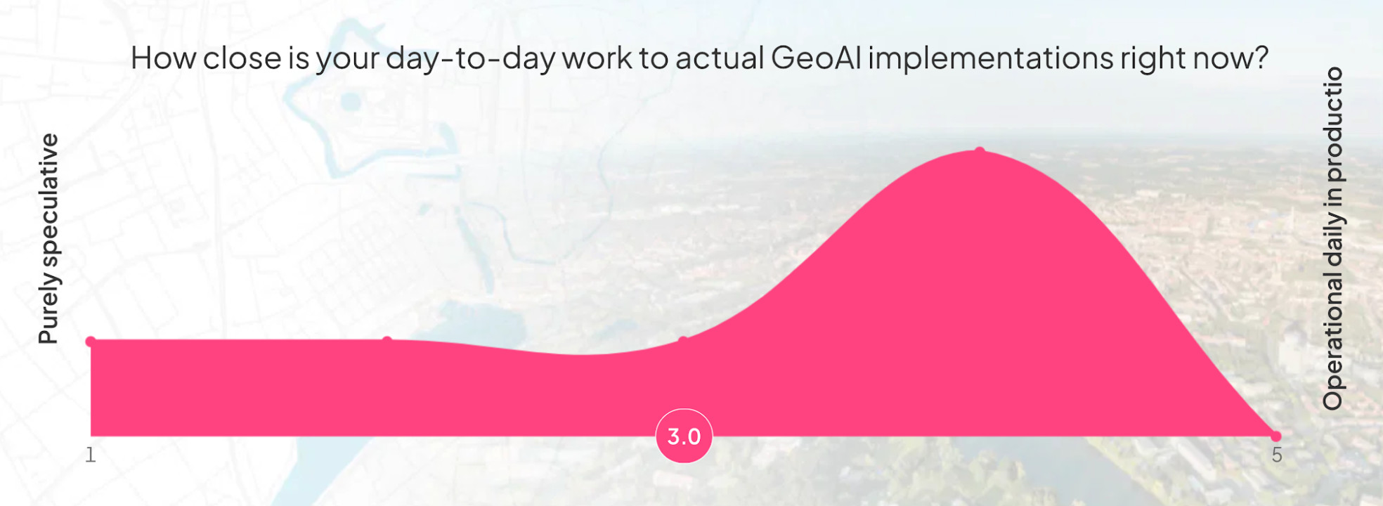
When rating how closely their work involves operational GeoAI implementations, attendees reported an average maturity score of 3.0 out of 5.0, indicating that the community is actively transitioning from initial testing toward operational production.
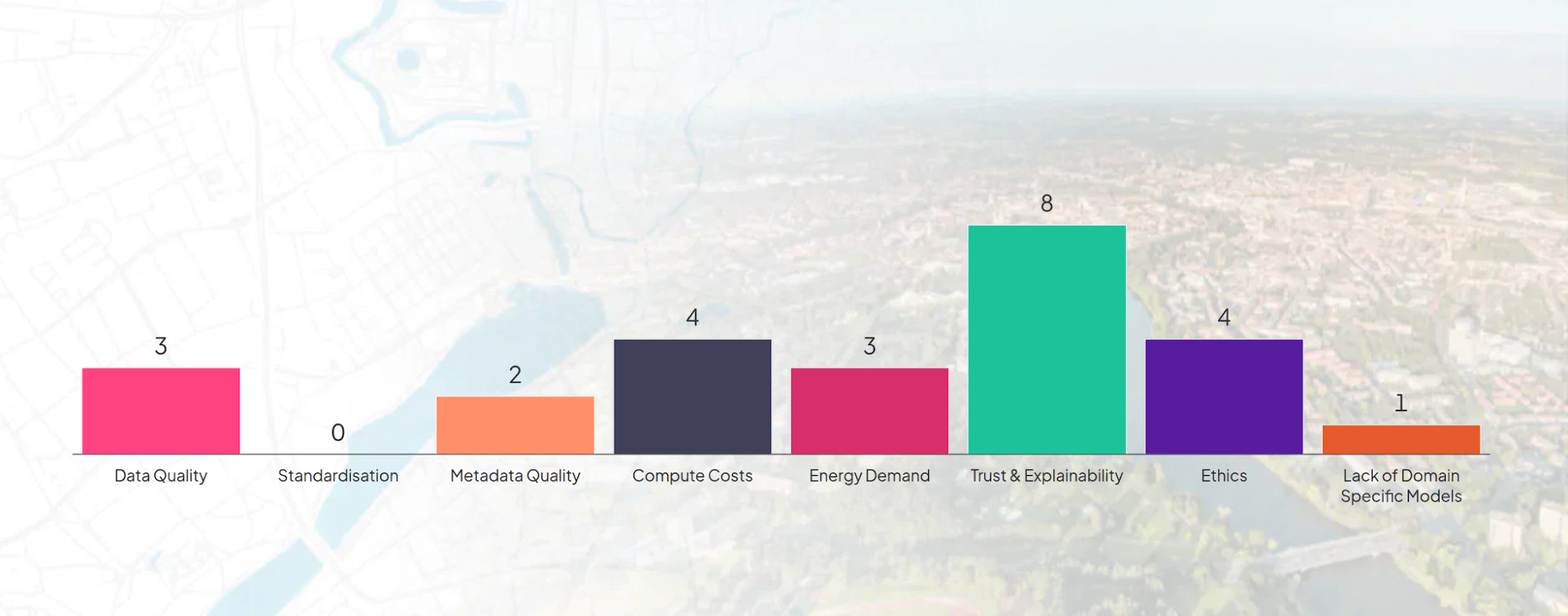
In identifying factors that limit GeoAI adoption, participants identified Trust and Explainability as the primary bottleneck, followed by Compute Costs, Data Quality, and Metadata Quality.
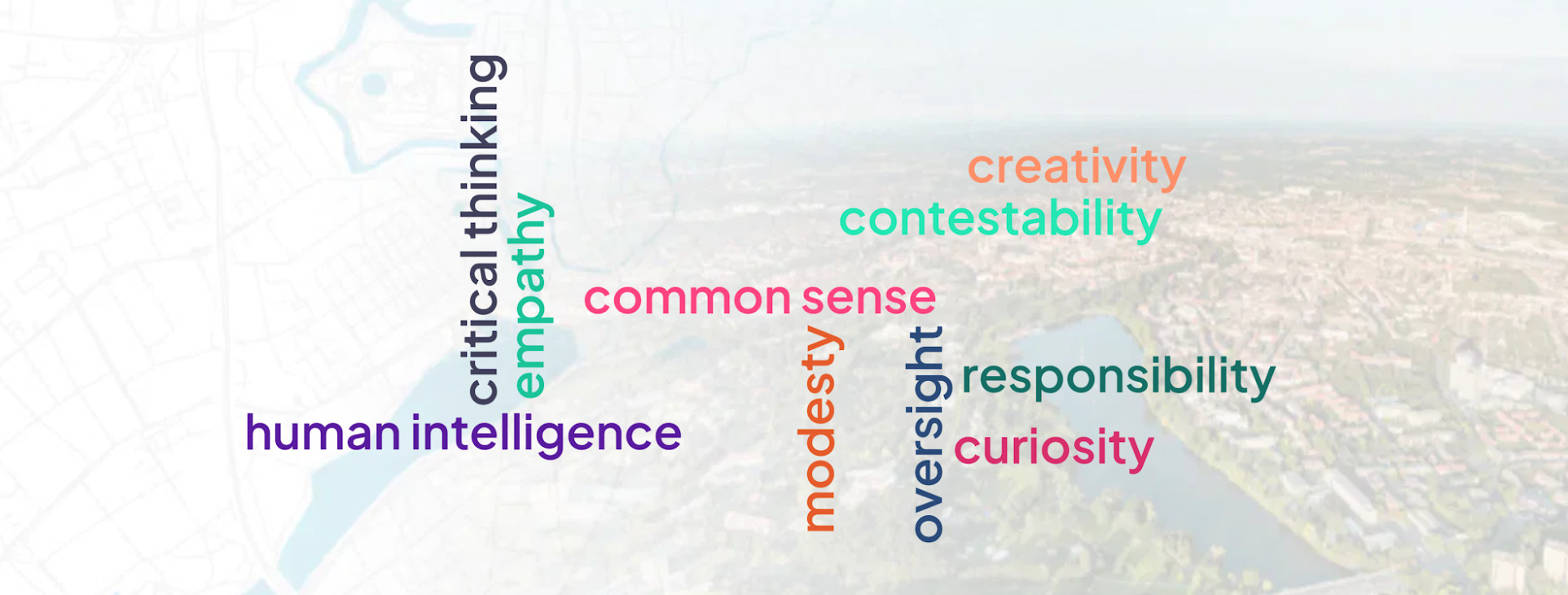
 Participants also emphasized essential human values that must be guarded as spatial algorithms gain autonomy, highlighting the human intelligence:
Looking Ahead
As 52°North steps into its third decade, ongoing initiatives will center on operationalizing responsible GeoAI, advancing urban digital twins, and strengthening open research data infrastructures through continuous collaboration across academia, industry, and the public sector.