
Implementing an automatic spatial unit aggregation for the indicator import function
Mülheim an der Ruhr was an instrumental practical partner during KomMonitor‘s research phase, significantly contributing to the system’s development. Consequently, the city already successfully uses KomMonitor as a social atlas and monitoring tool.
Our team focused on two significant user interface enhancements. We first integrated functionality for the spatial aggregation of indicators. This is designed to optimize data handling. Instead of importing socio-demographic data separately for various administrative units with differing spatial resolutions, data only needs to be provided for a limited number of spatial units. KomMonitor then automatically aggregates this data to generate higher-level spatial units, thereby reducing import overhead.
The second focus is on the initial development of a dashboard-style data presentation, culminating in a functional demonstrator. This primarily involves preparing existing KomMonitor components, currently implemented using the outdated AngularJS framework, to allow for flexible and configurable integration into a stand-alone, Angular-based dashboard application.
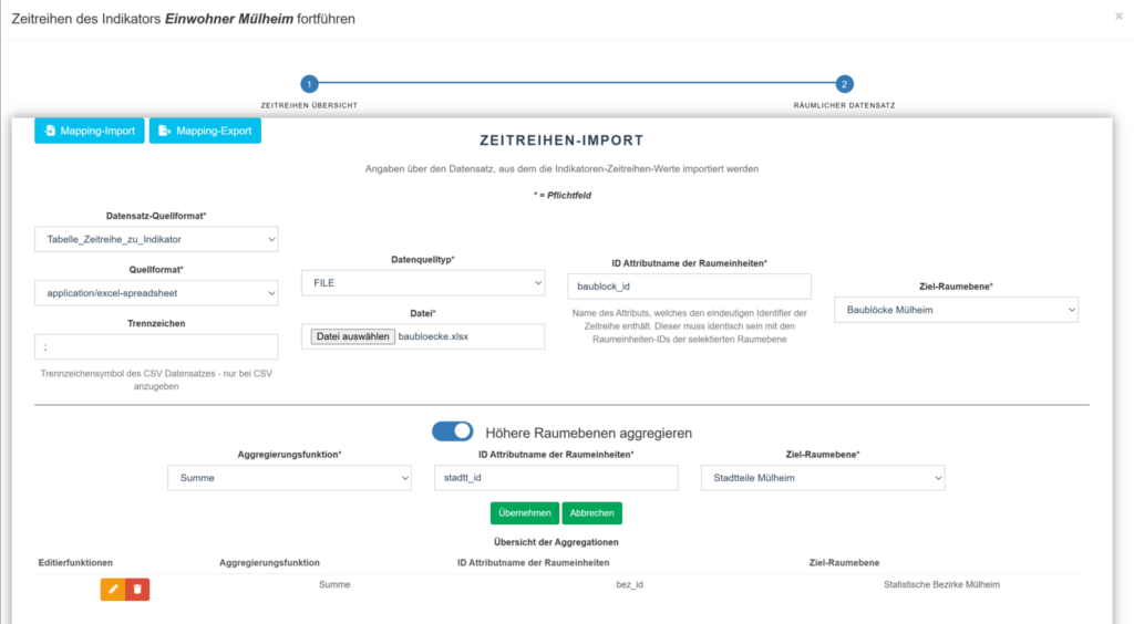
for several spatial units
Customer
Stadt Mülheim, Germany