Reducing Energy Consumption in Maritime Navigation
Optimizing ship routes for fuel efficiency while considering environmental conditions
The Weather Routing Tool (WRT) is a python package to discover ship routes that minimize fuel consumption while considering environmental conditions such as weather and water depth. Two algorithms have been fine-tuned to calculate optimal routes: an isofuel algorithm and a genetic algorithm. The package includes a constraints module to prevent land crossing and a simple fuel consumption model to quickly test the tool’s functionality. The development began in the context of the MariData project and continues under the Horizon Europe program TwinShip.
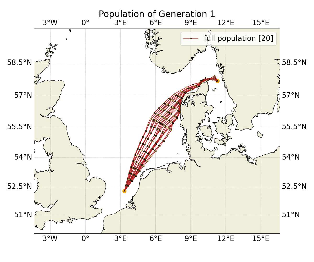
The isofuel algorithm is based on Hagiwara’s (1989) modified isochrone method, while the genetic algorithm is inspired by natural selection and built on the NSGA-II algorithm, as implemented by the Python library pymoo (Deb et al., 2002). These algorithms have different strengths and weaknesses, making them well-suited to address various problem scenarios, either independently or in combination. For example, the isofuel algorithm could be used to provide routes for the initial population of the genetic algorithm.
The WRT package provides all the necessary tools to quickly launch the routing calculation:
- functionality to download and harmonize atmospheric weather data, oceanic data and bathymetric data
- a simple fuel consumption model based on the Direct Power Method (ITTC, 2021)
- a constraint module that can consider minimum water depths, intermediate waypoints and valid parameter ranges of fuel consumption models
Benefits
- Continuous enhancements and testing.
- Close collaboration with maritime industry stakeholders and maritime science professionals through the MariData and TwinShip consortia.
- High modularity allows for easy expansion with further constraints or consumption modules.
- Low overhead allows for a quick launch of the tool.
- A sophisticated framework for unit tests.
- Highly configurable for expert users, but it also has reasonable default settings for beginners.
Fields of Application
Maritime transport, navigational support.
Project References
- MariGeoRoute
- MariData
- TwinShip
- Deb et. al. (2002): “A Fast and Elitist Multiobjective Genetic Algorithm: NSGA-II”, doi:10.1109/4235.996017
- Hagiwara, H. (1989, 11). Weather routing of (sail-assisted) motor vessels. Retrieved from http://resolver.tudelft.nl/uuid:a6112879-4298-40a6-91c7-d9a431a674c7
- ITTC – Recommended Procedures and Guidelines (2021): “Preparation, Conduct and Analysis of Speed/Power Trials”, https://www.ittc.info/media/9874/75-04-01-011.pdf
- Marzi, J., Harries, S., Schwarz, B., Scharf, M., Demmich, K., & Pontius, M. (2024, May 23). MariData – Digital Twin for Optimal Vessel Operations Impacting Ship Design. Proceedings of 15th International Marine Design Conference (IMDC-2024). https://doi.org/https://doi.org/10.59490/imdc.2024.875
Software
GitHub: https://github.com/52North/WeatherRoutingTool
Documentation: https://52north.github.io/WeatherRoutingTool/