Web-Based Urban Monitoring
Interactive visualization, analysis and management of spatio-temporal data to support urban planning and social monitoring
KomMonitor is a GIS web application consisting of modular software components that allow local authorities to integrate, link, and use any spatial data and indicators for monitoring processes. It is available as Open Source Software originally maintained by the Bochum University of Applied Sciences. 52°North is one of the main contributors and also provides deployment and operation services to interested municipalities.
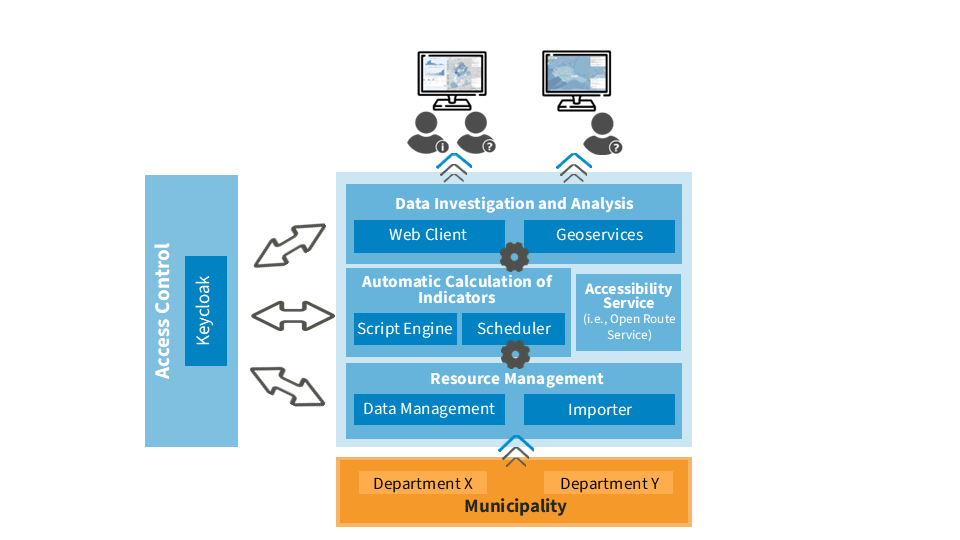
KomMonitor implements a coherent system of modular technical components in the sense of a geodata infrastructure. It provides an integrated data infrastructure that enables the linking and maintenance of interdisciplinary municipal (geo) data sets and statistical time series information at any spatial level. Through automated processing functions, new indicators can be derived from existing data sets. Finally, a web application enables the explorative display, analysis and evaluation of spatio-temporal indicators.
All aspects of this integrated data infrastructure are part of a service-oriented software architecture running natively on Docker. 52°North maintains the Docker deployments and provides installation and operations support. In addition, 52°North initiated several activities to prepare KomMonitor for cloud deployments. Our team developed Kubernetes manifest files for deploying KomMonitor within a hosted Kubernetes Cluster. We also run a demo instance of KomMonitor within an AWS cluster, and share our cloud experience with various projects and IT service providers.
In addition, we continued our pygeoapi activities and completed a proof of concept for replacing the KomMonitor Processing Engine with the pygeoapi implementation of the OGC API – Processes. The goal of this initiative is to introduce an interoperable processing interface to KomMonitor that can also be managed by modern workflow orchestration tools.

Benefits
- GIS-based spatio-temporal monitoring
- Combined analysis of timeseries and geo data
- Assessment of urban processes based on indicators
- Transferability and cross-sectional topics
- Variable spatial scale (from citywide to building block level)
- Data-driven local decision support
- Data visualization with diagrams and maps
- Intuitive, browser-supported usability
- Support for several data import formats
Fields of Application
urban monitoring, spatial planning, climate monitoring, social monitoring
Software
GitHub: https://github.com/kommonitor
