 To enable users to add, independently of the main software developer, functionality to the core of the ILWIS software, a possibility was created to add plug-ins to ILWIS. Once installed, these plug-ins appear under the main ILWIS Operations menu and the Operation-Tree. If activated a new toolbox graphical user interface and menu appears. The users can develop these plug-ins by themselves or use portions of available plug-ins to further develop their own plug-in(s). All routines are open and can be customized by the user. Also external software utilities can be added to complement the existing GIS and RS capabilities of ILWIS.
A number of plug-ins have been developed over time, like the GEONETCast Toolbox, the In-Situ and On-line Data Toolbox, the MaMaSe Toolbox, the Water and Food Security Ethiopia Toolbox, the MESA-SADC Toolbox, the FAO-Frame Toolbox, the Cabo Verde Toolbox and the Triple Sensor Toolbox. Another developed utility is the Sentinel EO4SD Toolbox. This toolbox is developed under Python and is using ILWIS-Objects. In the subsequent pages additional information is provided on some of the currently supported plug-ins.
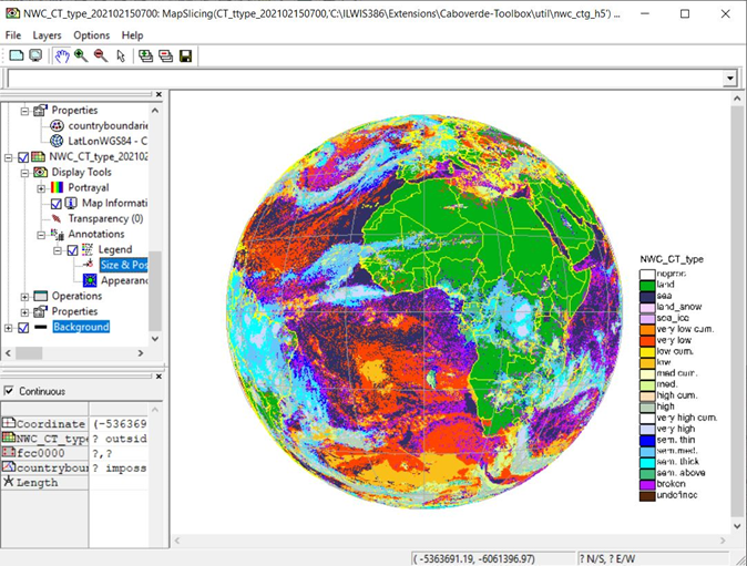
Below, an example is given of the GEONETCast Toolbox plug-in showing the result of an imported dataset from the Satellite Application Facility on support to Nowcasting and Very Short Range Forecasting. The cloud type product is shown.